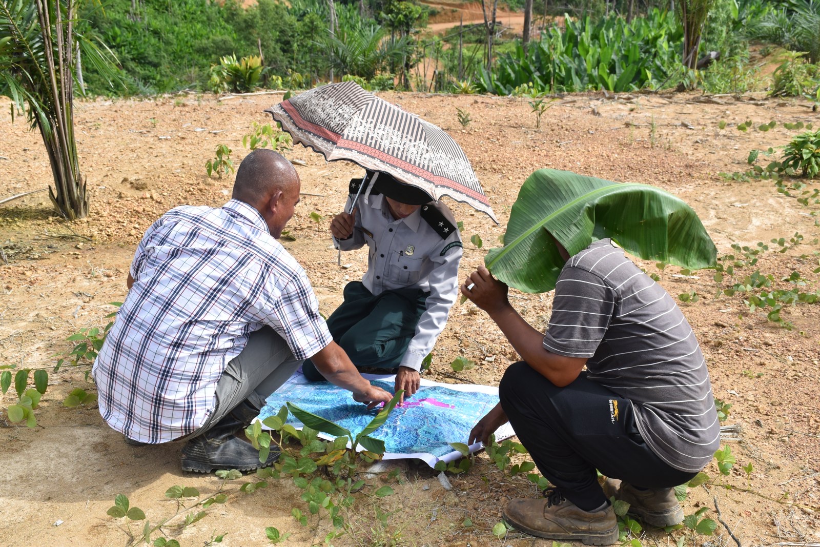
Land governance · 2015 – 2019
OneMap Myanmar
One country, one map
Consolidating the scattered land data of a country opening up - so that land, the source of so much conflict, could become legible and negotiable.
A decade to give a fractured nation one shared map.
OneMap Myanmar (2015-2025) was a decade-long effort to consolidate Myanmar's land-related spatial data, build technical capacity across state and civil society, and feed evidence into land reform. Funded by the Swiss Agency for Development and Cooperation (SDC) and led by the Centre for Development and Environment (CDE) at the University of Bern, it grew out of the 2016 National Land Use Policy's call for a "One Map" system.
I led it as Country Director and Chief Technical Advisor through its first four, most formative years - from launch to institutionalisation.
12M
CHF, 4 phases
20+
agencies aggregated
30
staff, 3 offices
13
partner ministries
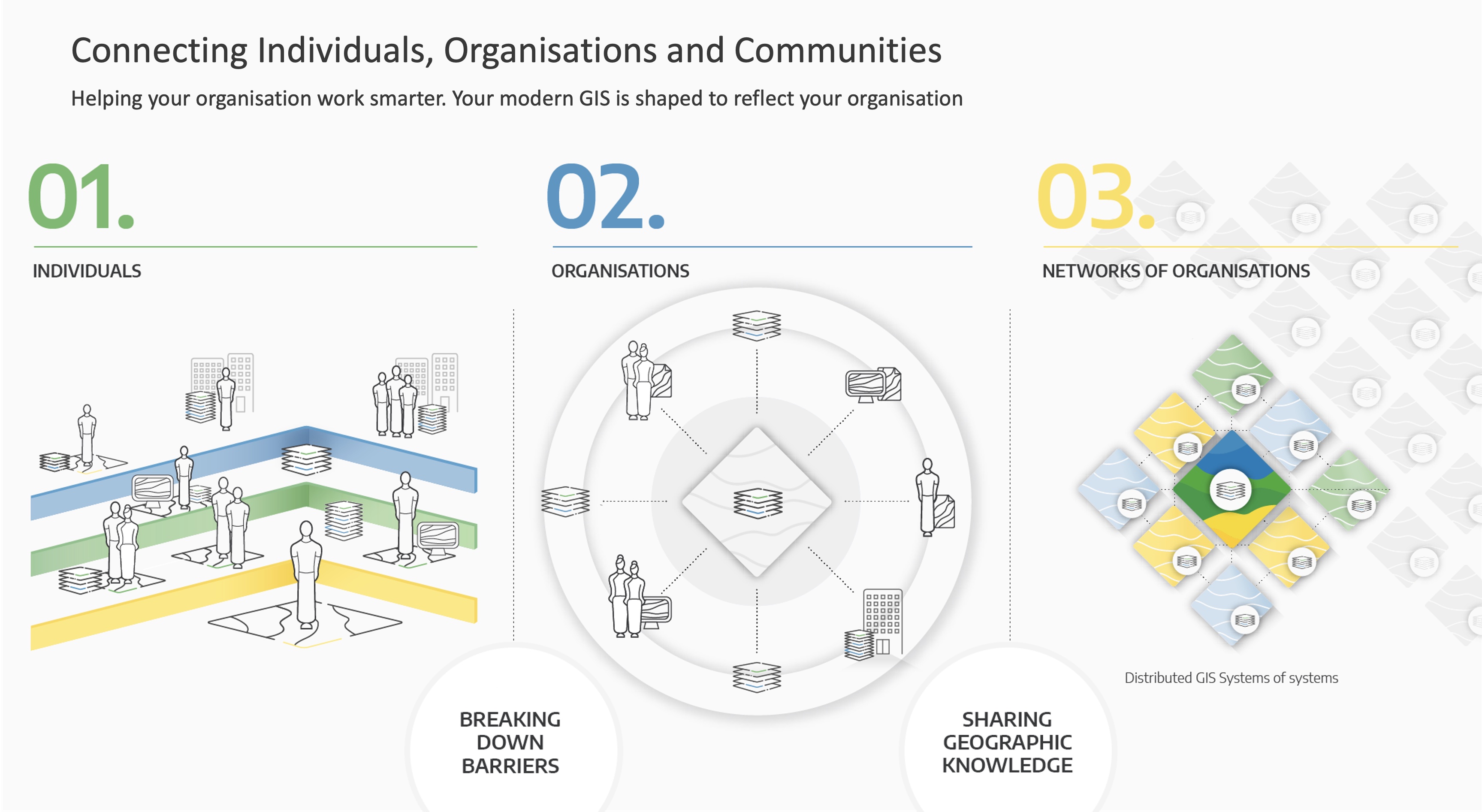
Four work streams
One platform, one posture
A national geoportal
Aggregating datasets scattered across more than twenty agencies, digitising inaccessible archives, building the country's first unified land-data platform.
Capacity development
Training the staff of twelve ministries in spatial data and building data-sharing frameworks where silos once ruled.
Knowledge production
Maps, reports and analyses that fed reform debates directly - from the Survey Law to the 2019 Forest Rules.
Multi-stakeholder dialogue
Working with government in official arenas, and equipping civil society bilaterally so it could arrive informed at the table.
Embedded research
Producing analysis close to those who use it
What set OMM apart was not so much the platform as the knowledge it produced and the processes it enabled. Its influence worked through artefacts - maps, reports, datasets - and through an embedded presence in the making of policy.
What the maps moved
Case studies
Tanintharyi
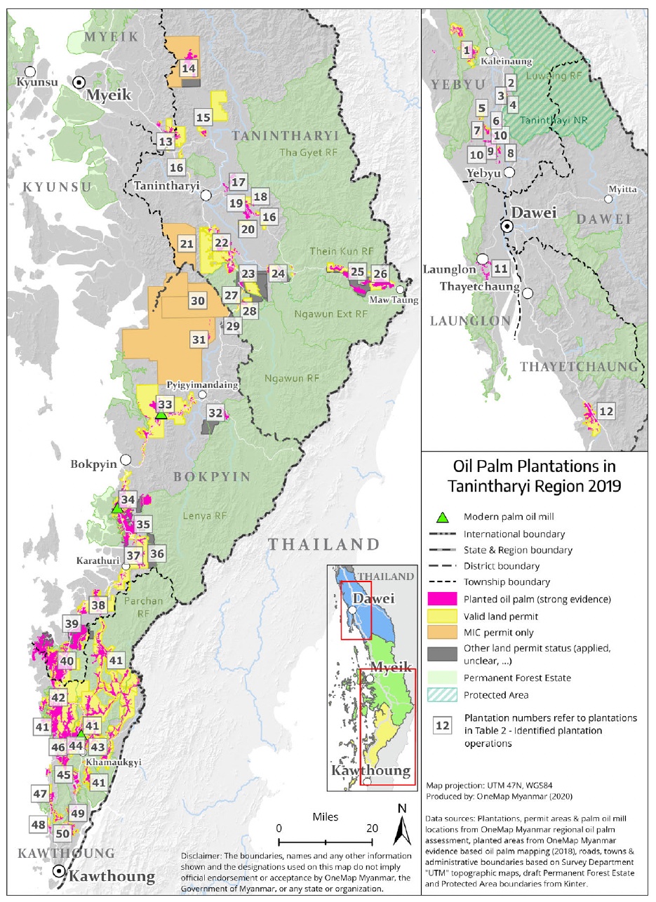
Oil palm & power
A multi-stakeholder review of oil-palm concessions revealed the gulf between permits granted and plantations actually planted - much of the concession area remaining unconverted forest. Technical evidence, at times rejected when it threatened established interests, ultimately fed a national audit.
Published in Nature Scientific Reports (2019) and the European Journal of Development Research (2020).
Naga Land
Customary tenure
At the communities' request, participatory mapping of 36 villages and satellite analysis of shifting cultivation: "multifunctionality from below." A deliberate choice not to draw boundaries - and an award-winning documentary.
EITI · Extractives
Mining transparency
A mapping platform for the extractive industries, whose data and relationships survived the 2021 coup by migrating to other hosts.
Unified geodatabase
Ambition meets reality
Building a unified land database ran into institutional realities - bureaucratic silos, conflicting legal frameworks, outdated boundaries. A lesson in the limits of harmonisation.
Navigating turbulence
Structural headwinds
OMM operated against the current: inconsistent high-level political backing, agencies guarding "their" data, civil society at first wary that formalised data might legitimise dispossession, overlapping legal frameworks. And, in 2021, the coup.
What survived were the datasets, the relationships and the skills - because they had been built in proximity, not only in systems.
Academic output
Related publications
Assembling Drones, Activists and Oil Palms: Implications of a Multi-stakeholder Land Platform for State Formation in Myanmar
Baechtold, Bastide, Lundsgaard-Hansen - European Journal of Development Research, 2020
Oil palm concessions in southern Myanmar consist mostly of unconverted forest
Nomura, Mitchard, Patenaude, Bastide et al. - Nature Scientific Reports, 2019
OneMap Myanmar - Enabling a multi-stakeholder environment for the co-production of data, information and knowledge on land
Bastide & Heinimann - World Bank Annual Conference on Land and Poverty, 2018
The Asian root
Myanmar, and what came next
OneMap was the biggest undertaking of my life - and, in Yangon, I also defended my thesis and built the BBZU mobile studio.